Giant’s Rib Escarpment Education Network’s waterfall of the month for December 2014 is Mountain Spring Falls.
For those who investigated the GREEN Waterfall of the Month for November 2014, Heritage Green Falls, they may have noticed an unusual waterfall located about 30m south of it, emerging from a karst type opening in the side of the ravine. This waterfall is known as Mountain Spring Falls which originates from a groundwater creek on the east side of Davis Creek, about half way between Little Davis Falls and Felker’s Falls in the Felker’s Falls Conservation Area. Its coordinates are 43.2045 N / 79.788 W.
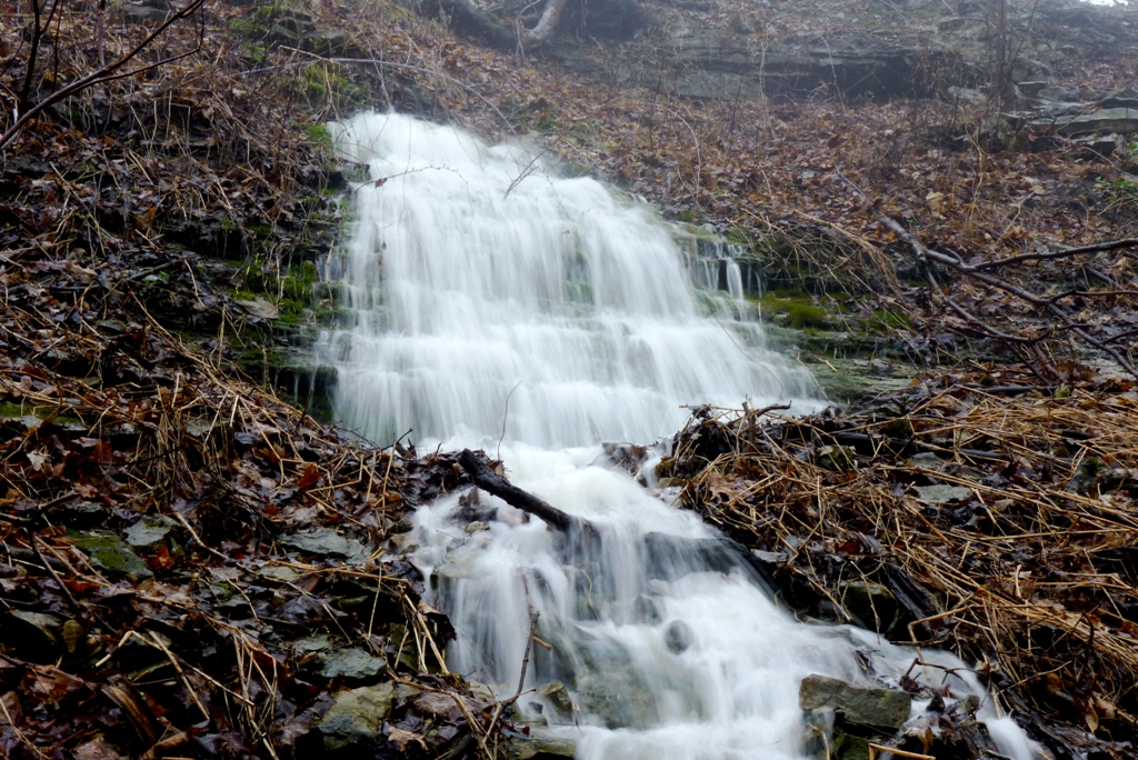
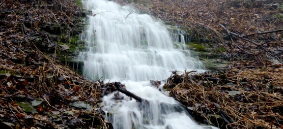
Mountain Spring Falls is considered a Terraced Ribbon type falls and has a height of approximately 15 m. (50 ft) and a crest width of 2.4 m (8 ft.). There is no defined ravine associated with this waterfall, thus it is quite surprising to see it when flowing. (see photo). This waterfall, dries up often, thus plan to visit it after a heavy rainfall or during the winter snow melt.
To visit Mountain Spring Falls, from QEW take the Red Hill Valley Parkway South. Keep left onto Mud St. Keep straight on Mud St. W. Turn left onto Paramount Drive. Turn right onto Ackland Dr. Park at the Felker’s Falls CA. Follow the Bruce Trail which crosses Davis Creek above Felker’s Falls via a bridge and then back towards Felker’s Falls and past it until you reach a small ravine as shown in the attached map where Heritage Green Falls is located. Then walk about 30m south (back from where you have just come) and if flowing, Mountain Spring Falls can be seen and heard emerging partway down the ravine slope from a karst opening.
Joe Hollick.